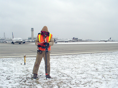
KS Associates performed surveying and mapping services for the design of the Cleveland Hopkins International Airport (CLE) Runway 10-28 Safety Improvements project. The goal of the project was to re-position the ends of runway 10-28, elevate the 28 end, and reduce existing obstructions.
Services included performing topographic surveying and mapping the existing runway and associated taxiways, and locating utilities and NAVAID locations affected by the project. An Aeronautical Survey was also completed and submitted to FAA in accordance with the Advisory Circulars 150/5300-16, 150/5300-17B, and 150/5300-18B. Airport data features were mapped to meet the FAA Airport Geographic Information System (AGIS) requirements. Challenges included the need to remain in close communication with airport operations personnel and coordinating runway closures to safely and securely access runways and taxiways. In some locations, surveys were performed at night due to limited access during daytime hours.